Precision Mapping
We capture your site using the DJI Matrice 350 RTK enterprise platform, achieving ground sample distances of up to 1.2 cm/px at 100 m AGL. Every project is referenced to ≥ 4 ground control points (GCPs) in the Swiss national coordinate system CH1903+ / LV95 (EPSG:2056), producing RMSE-validated orthomosaics and point clouds to the standard expected by licensed surveyors (Geometers).
Output formats are matched to your software workflow: GeoTIFF for GIS analysis, .LAS/.LAZ for point cloud processing, and .DXF for CAD integration. The accompanying quality report documents all capture parameters, sensor settings, and accuracy metrics.
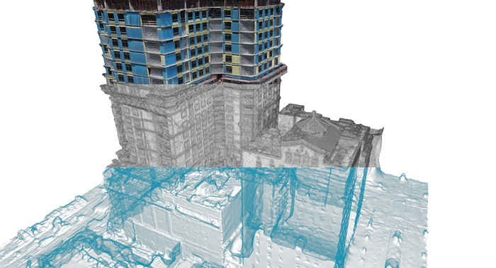
Construction BIM / Scan-to-BIM
Our Scan-to-BIM workflows deliver vegetation-filtered, fully classified point clouds in .LAS and .LAZ formats, optimised for direct import into Autodesk Revit and Graphisoft ArchiCAD. Classification follows the ASPRS standard, distinguishing ground, vegetation, buildings, and engineered structures for immediate use in BIM modelling.
On request, we also supply georeferenced floor plans, cross-sections, and 3D models in IFC or DWG format. All datasets are referenced to CH1903+ / LV95 and comply with SIA standards for digital construction documentation.
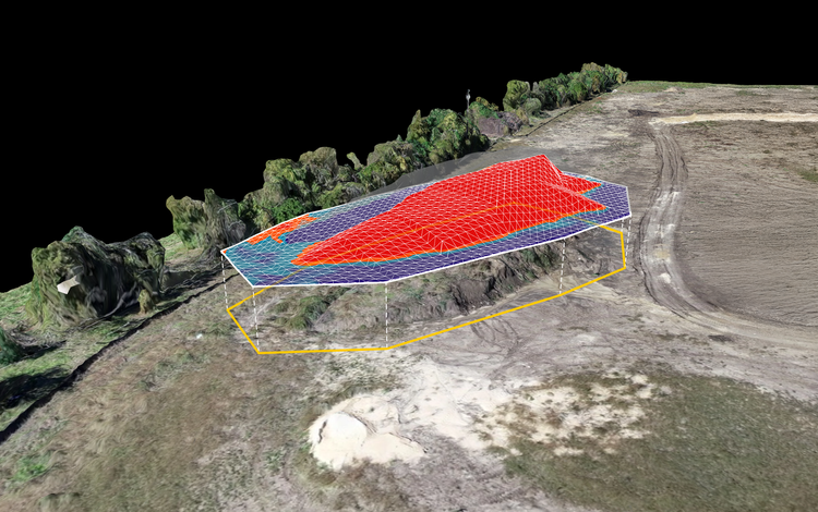
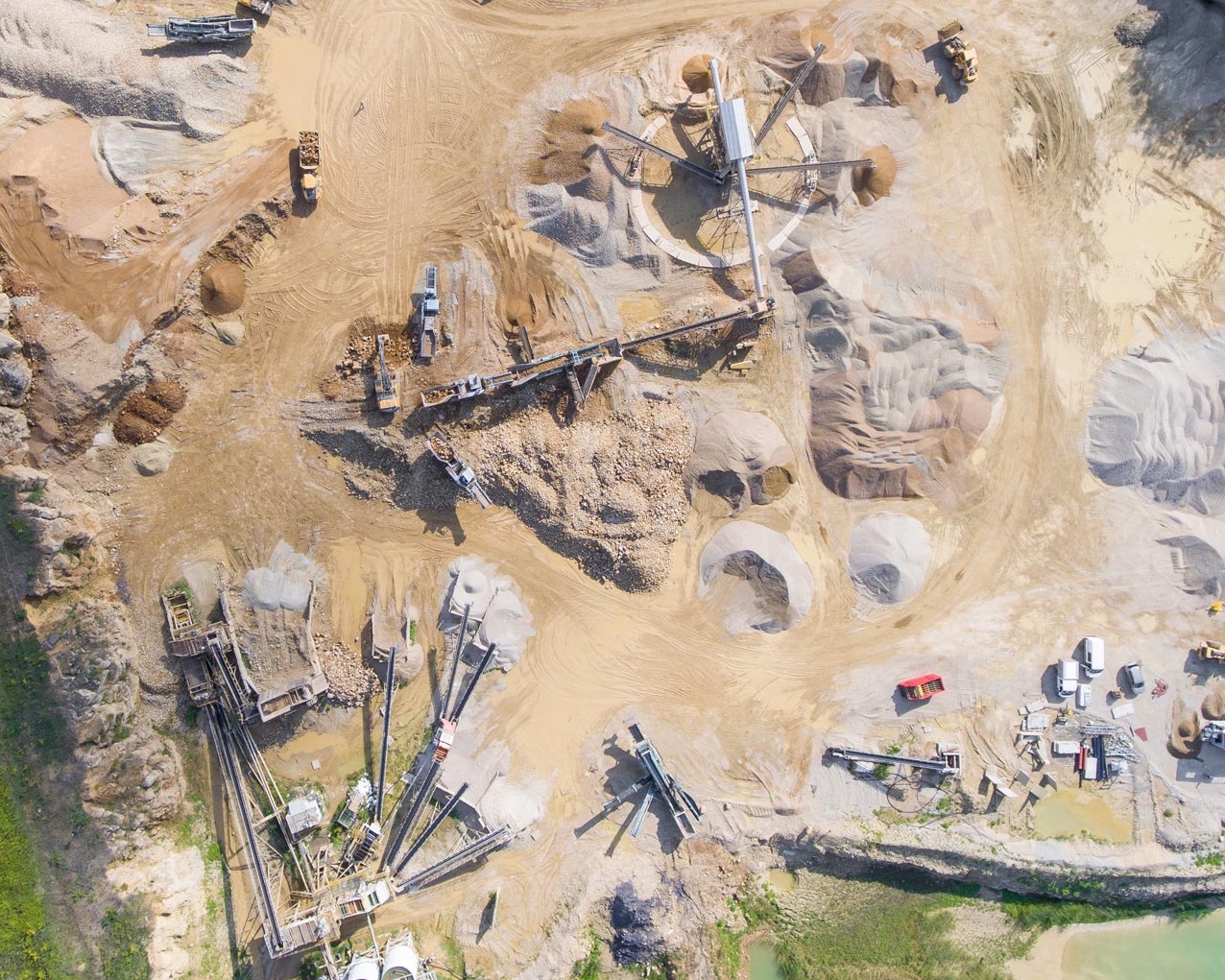
Volume Analysis
Our volumetric calculations for excavation (Aushub) and aggregate stockpiles achieve error margins below 1% against reference measurements, documented, repeatable, and admissible as evidence. Drone-based spatial capture replaces time-consuming manual survey and delivers more precise results in a fraction of the time.
Clients receive a structured volume report with delta analysis between flights, ideal for construction phase monitoring, mass balance verification, and documentation for the Bauherr (principal). Output as .CSV, .PDF, and .DXF.
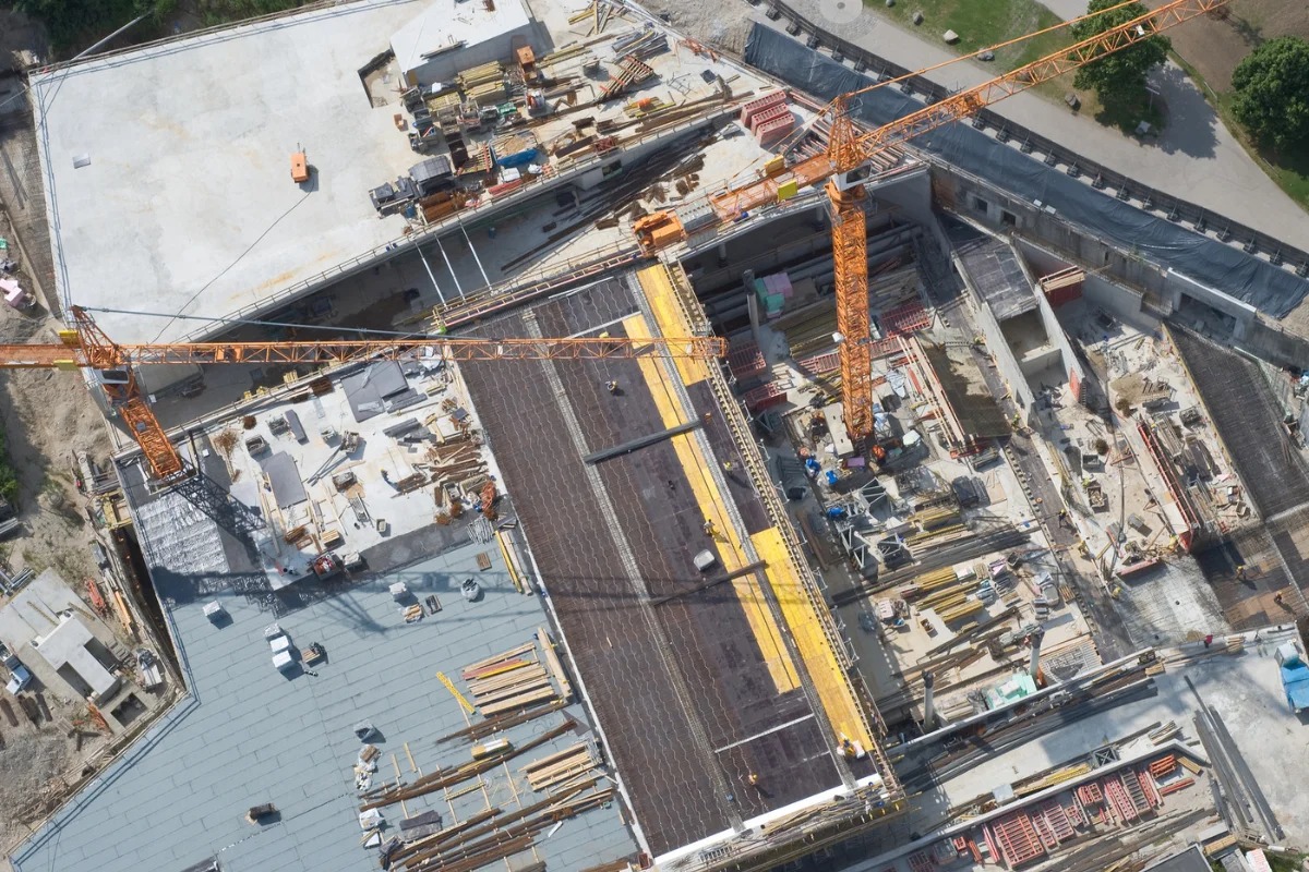
Urban Inspections
As a BAZL/FOCA-certified operator in the Specific Category (PDRA-S01), we are cleared to conduct operations in close proximity to people and structures in populated areas, without requiring special exemptions. This enables façade and infrastructure inspections even in densely built environments.
High-resolution image sequences enable millimetre-level capture of cracks, corrosion, and structural defects on façades, bridges, and retaining walls. Results are delivered as a georeferenced image report with damage classification and coordinate references.