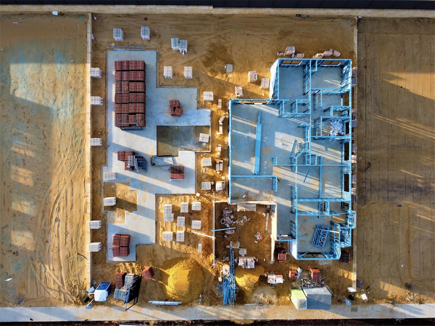
Infrastructure & Construction sites
Rapid and safe data for monitoring progress, ensuring safety, and managing assets.
We deliver high-resolution maps, 3D models, volumetric measurements, and detailed inspection reports for informed decision-making throughout a project's lifecycle.

Real Estate
We offer stunning aerial perspectives to enhance property marketing and provide detailed site insights.
Outputs include high-resolution photos/videos, 360-degree panoramas, virtual tours, and precise property boundary mapping.
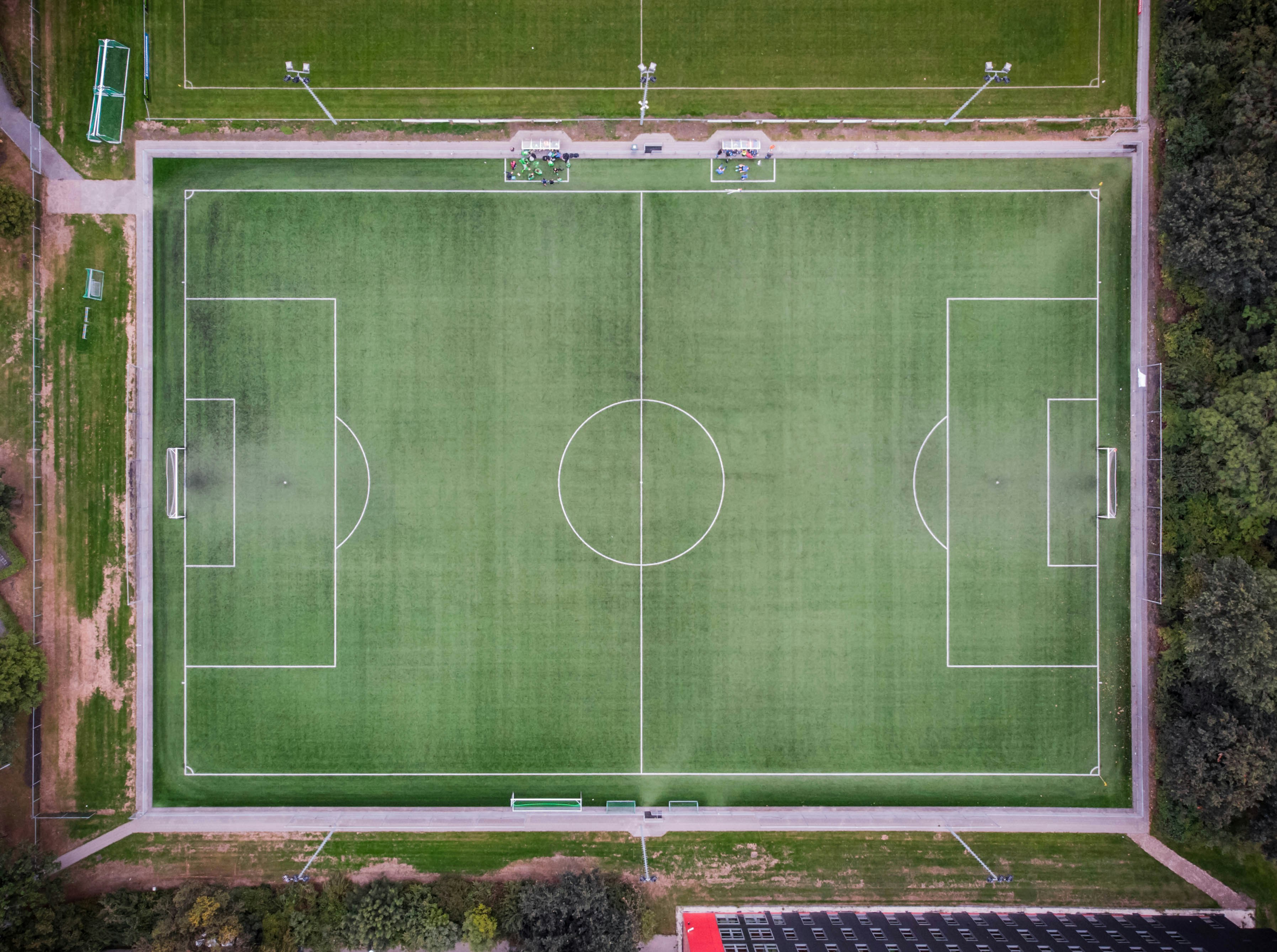
Sports Facilities
Drones aid in facility management, security, and event operations, providing comprehensive overviews of large venues.
We offer detailed maps of grounds, 3D facility models, real-time surveillance footage, and inspection images for optimal upkeep and safety.
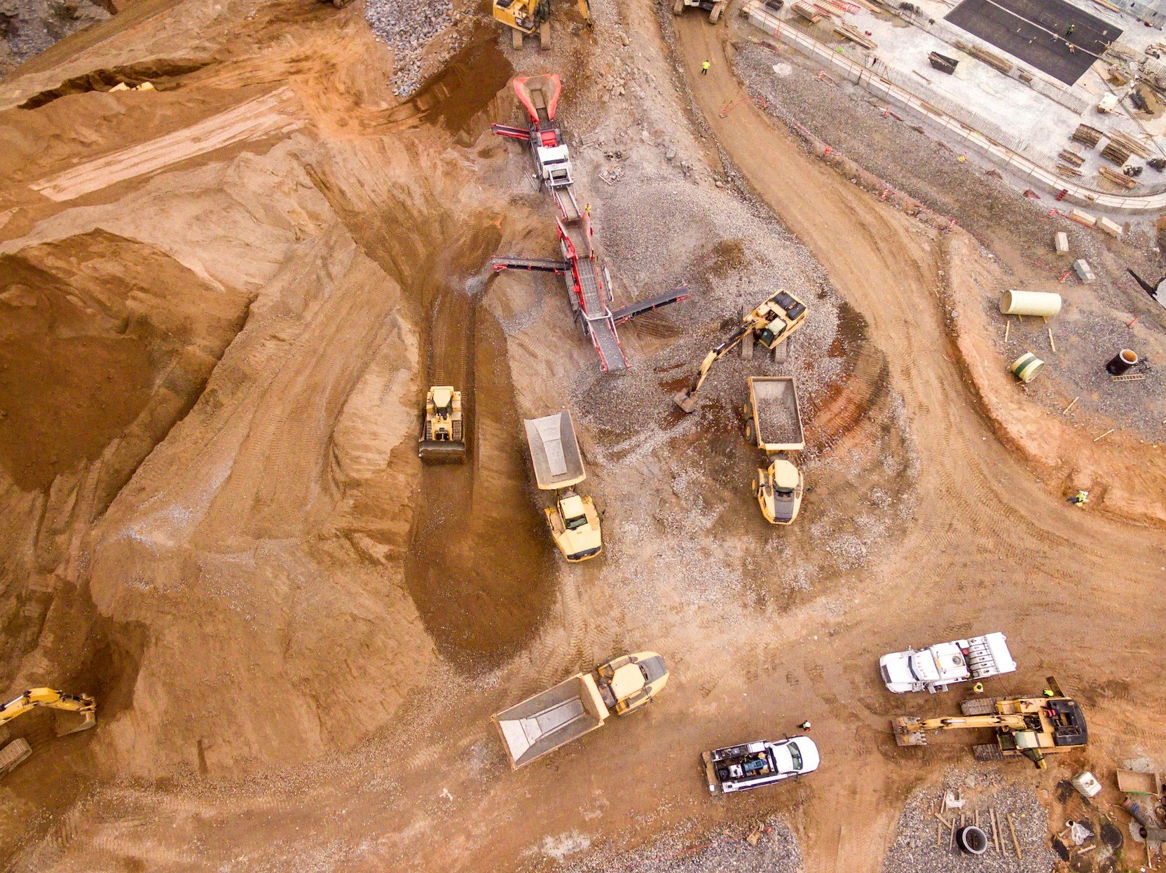
Open-Pit Mines & Quarries
Drones deliver faster, safer, and more accurate methods for surveying, inventory, and monitoring in hazardous environments.
Key outputs include high-accuracy topographic maps, 3D models, precise volumetric calculations of stockpiles, and crucial data for slope stability analysis.